Close Menu
Meteorological Technology International
  • News
    • A-E
      • Agriculture
      • Automated Weather Stations
      • Aviation
      • Climate Measurement
      • Data
      • Developing Countries
      • Digital Applications
      • Early Warning Systems
      • Extreme Weather
    • G-P
      • Hydrology
      • Lidar
      • Lightning Detection
      • New Appointments
      • Nowcasting
      • Numerical Weather Prediction
      • Polar Weather
    • R-S
      • Radar
      • Rainfall
      • Remote Sensing
      • Renewable Energy
      • Satellites
      • Solar
      • Space Weather
      • Supercomputers
    • T-Z
      • Training
      • Transport
      • Weather Instruments
      • Wind
      • World Meteorological Organization
      • Meteorological Technology World Expo
  • Features
  • Online Magazines
    • January 2026
    • April 2025
    • January 2025
    • September 2024
    • April 2024
    • Archive Issues
    • Subscribe Free!
  • Opinion
  • Videos
  • Supplier Spotlight
  • Expo
LinkedIn X (Twitter) Facebook
  • Sign-up for Free Weekly E-Newsletter
  • Meet the Editors
  • Contact Us
  • Media Pack
LinkedIn Facebook
Subscribe
Meteorological Technology International
  • News
      • Agriculture
      • Automated Weather Stations
      • Aviation
      • Climate Measurement
      • Data
      • Developing Countries
      • Digital Applications
      • Early Warning Systems
      • Extreme Weather
      • Hydrology
      • Lidar
      • Lightning Detection
      • New Appointments
      • Nowcasting
      • Numerical Weather Prediction
      • Polar Weather
      • Radar
      • Rainfall
      • Remote Sensing
      • Renewable Energy
      • Satellites
      • Solar
      • Space Weather
      • Supercomputers
      • Training
      • Transport
      • Weather Instruments
      • Wind
      • World Meteorological Organization
      • Meteorological Technology World Expo
  • Features
  • Online Magazines
    1. January 2026
    2. September 2025
    3. April 2025
    4. January 2025
    5. September 2024
    6. April 2024
    7. January 2024
    8. September 2023
    9. April 2023
    10. Archive Issues
    11. Subscribe Free!
    Featured
    November 27, 2025

    In this Issue – January 2026

    By Hazel KingNovember 27, 2025
    Recent

    In this Issue – January 2026

    November 27, 2025

    In this Issue – September 2025

    August 11, 2025

    In this Issue – April 2025

    April 15, 2025
  • Opinion
  • Videos
  • Supplier Spotlight
  • Expo
Facebook LinkedIn
Subscribe
Meteorological Technology International
Climate Measurement

Climate model simulates weather phenomena at scales of 9km worldwide

Elizabeth BakerBy Elizabeth BakerJuly 22, 20254 Mins Read
Share LinkedIn Facebook Twitter Email
A snapshot of simulated climate conditions.
Blue/red shading: sea surface temperature deviations from zonal mean; gray/white shading: low clouds; green/pink shading: 10m wind speed; blue/yellow shading in upper panels: hurricane precipitation. The figure illustrates the ubiquity of mesoscale climate phenomena, such as tropical instability waves in the equatorial Atlantic and Pacific, hurricanes (making landfall in Hawaiʻi in this snapshot), ocean cold wakes generated by hurricanes, stratocumulus cloud decks and patchy daytime convection over the Amazon forest
Share
LinkedIn Facebook Twitter Email

A team of scientists from the IBS Center for Climate Physics (ICCP), Pusan National University in South Korea and the Alfred Wegener Institute, Helmholtz Centre for Polar and Marine Research (AWI) has created a high-resolution climate model. According to the research, published in the open-access journal Earth System Dynamics, the model provides unprecedented insights into Earth’s future climate and its variability.

Weather computer model

Using the AWI-CM3 Earth system model, a novel iterative global modeling protocol, and two of South Korea’s supercomputers (Aleph at the Institute for Basic Science and Guru at the Korea Meteorological Administration), the researchers simulated climate change at scales of 9km in the atmosphere and 4-25km in the ocean. These extensive computer model simulations offer a more accurate representation of future climate conditions, enabling better planning for climate adaptation.

The AWI-CM3 high-resolution model represents global climate, including small-scale phenomena, such as rainfall in mountainous regions, coastal and island climate processes, hurricanes and ocean turbulence. By resolving more regional details and their interactions with the large-scale atmosphere and ocean circulations, the model reportedly demonstrates better performance than lower-resolution climate models.

A main product of the simulations was a set of detailed global maps of expected climate change (such as temperature, rainfall, winds, ocean currents, etc) for an anticipated 1°C future global warming.

Climate model simulates weather phenomena at scales of 9km worldwide.
Download data of climate change (such as temperature, wind speed, precipitation, etc) per 1°C global warming from 9km AWI-CM3 Global Warming simulations. Go to: https://climatedata.ibs.re.kr/data/papers/moon-et-al-2024-earth-system-dynamics

Moon Ja-Yeon from the ICCP, and lead author of the study, stated, “It is important to keep in mind that global warming is spatially quite heterogenous. For a 1°C global temperature increase, the Siberian and Canadian Arctic will warm by about 2°C, whereas the Arctic Ocean will experience warming of up to 5°C. In high mountain regions, such as the Himalayas, the Andes and the Hindu Kush, the model simulates a 45-60% acceleration relative to the global mean.”

Sharing the knowledge

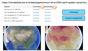
To ensure broad access to these high-resolution climate projections, the team launched an interactive data platform, where users can explore future climate change on regional and global scales. Normalized climate change data for a 1°C global warming level can be downloaded and opened directly in the Google Earth application. This data can provide information on expected future changes in climate variables, such as wind speed and clouds, which are relevant for the future deployment of wind and solar farms, respectively.

Prof. Thomas Jung from the AWI and co-corresponding author of the study, commented, “Our study also highlights the regional impacts of major modes of climate variability, such as the Madden Julian Oscillation, the North Atlantic Oscillation and the El Niño-Southern Oscillation, as well as their response to greenhouse warming.”

Regional findings

According to the AWI-CM3 simulations, the amplitude of the Madden Julian Oscillation and of the alternating El Niño and La Niña events will increase in the future, which will lead to intensified rainfall impacts in affected regions. ​The simulations also indicate an increase in the frequency and intensity of extreme rainfall events (>50mm/day) in areas such as eastern Asia, the Himalayas, the Andes, Amazonia, mountaintops in Africa and the east coast of North America, with significant implications for flooding, erosion and landslides.

Prof. Axel Timmermann, director of the ICCP and co-corresponding author of the study, said, “Most global climate models used in the assessment reports of the IPCC are too coarse to resolve small islands, such as those in the western tropical Pacific. These islands are already threatened by global sea-level rise. Our new climate model simulations now provide new regional insights into what these regions can expect in terms of changes in ocean currents, temperatures, rainfall patterns and weather extremes. We hope that our dataset will be used extensively by planners, policy- and decision-makers and the public.”

In related news, scientists at Sun Yat-Sen University recently developed SYCIM2.0, an Earth system model built for climate simulation

Previous ArticleSemi-empirical model improves forecasting of Earth’s magnetic storms
Next Article EUMETSAT takes control of Meteosat Third Generation Sounder 1 satellite

Read Similar Stories

Climate Measurement

Study identifies atmospheric trigger behind flash droughts in Puerto Rico

April 15, 20263 Mins Read
Satellites

AI tool uses weather satellite data to map ocean currents in near real time

April 14, 20263 Mins Read
Climate Measurement

New tool speeds up climate model evaluation

April 13, 20262 Mins Read
Latest News

Northumbria University secures £4m to study Earth’s radiation belts

April 16, 2026

AI model improves real-time prediction of wildfire spread

April 16, 2026

Study identifies atmospheric trigger behind flash droughts in Puerto Rico

April 15, 2026

Receive breaking stories and features in your inbox each week, for free


Enter your email address:


Supplier Spotlights
  • ROTRONIC AG
Getting in Touch
  • Contact Us / Advertise
  • Meet the Editors
  • Media Pack
  • Free Weekly E-Newsletter
Our Social Channels
  • Facebook
  • LinkedIn
© 2026 UKi Media & Events a division of UKIP Media & Events Ltd
  • Cookie Policy
  • Privacy Policy
  • Terms and Conditions
  • Notice and Takedown Policy

Type above and press Enter to search. Press Esc to cancel.