Scientists at the US National Science Foundation National Center for Atmospheric Research (NSF NCAR) have found that fires that blaze through the wildland-urban interface (WUI) are becoming more common around the globe – a trend that is likely to continue for at least the next two decades. Funding for the research came from the NOAA. The study was published in Environmental Research Letters.
Wildland-urban interface
The research team used satellite observations and machine learning (ML) techniques to produce a unique database of WUI areas and fires worldwide, dating back about two decades. The research found that the overall number of all fires worldwide has declined, as has the total area burned. However, the fraction of global fires that occur in WUI areas increased by about 23% from 2005 to 2020. Even more significantly, the global area burned by WUI fires during the same period increased by about 35% as a fraction of all burned areas.
WUI areas are expanding worldwide, especially in rapidly urbanizing regions in Africa. As newly constructed developments move into areas of wild vegetation, the risk of fires increases. The paper did not focus on the role of climate change, although the authors said the database can help scientists better fingerprint the role of climate change in fires.
WUI areas are generally defined as the location where urban land use and wildland vegetation come into contact or intermingle. Fires in such areas are thought to be especially dangerous, both because they imperil large numbers of people and structures and because, by burning manufactured materials instead of vegetation, they emit far more toxins than forest and grassland fires.
“Wildland-urban interface fires are a major concern for many people in the United States and globally, and through this study we now know they have increased in recent years and will likely continue doing so in the future,” said NSF NCAR scientist Wenfu Tang, the lead author of the new paper. “This is important as a first step to looking at emissions from these fires and their impacts on human health.”
Constructing a global database
To understand more about trends in WUI fires, Tang and her colleagues turned to a global high-resolution map of 2020 WUI fires, created by Franz Schug of the University of Wisconsin-Madison. They also analyzed data about Earth’s surface from NASA’s Moderate Resolution Imaging Spectroradiometer (MODIS) satellite instrument.
By applying ML techniques to the map and satellite data, they quantified the relationship of fires with such variables as land cover and population density. They then used those quantitative relationships to generate a global database of WUI areas and WUI fires, going back 20 years at a resolution of 9km (5.6 miles).
The researchers confirmed the accuracy of the database by comparing it with independent WUI data sets previously developed for a few years within the same time period, including for the continental USA and globally.
In analyzing the new database, the researchers found that WUI areas have grown in all populated continents by 24% from 2001 to 2020, with the largest increase occurring in Africa.
Largely as a result, fires in WUI areas have also become more common. Since 2005, they have increased from 3.5% to 4.3% of all fires. In North America, the WUI fraction of all fire counts is even higher (up to 9%), with WUI fires in 2015-2020 becoming particularly large and more destructive.
“This is the first map of its kind that enables us to look at how WUI fires have been evolving globally over the past two decades,” said NSF NCAR scientist Cenlin He, a co-author of the study. “It shows that WUI fires have increased on every populated continent.”
Even as WUI blazes loom as a greater threat, the scientists noted that fires overall have been on the decline. Since 2005, the total number of fires worldwide decreased by 10%, and the amount of burned areas decreased by 22%, according to satellite observations analyzed in the research.
Turning to the future, Tang and her colleagues integrated the WUI database with the NSF NCAR-based Community Earth System Model, which simulates global climate and fires, to determine the likely trends in WUI fires through 2030 and 2040.
If WUI areas continue to expand and greenhouse gases continue to be emitted at a high rate, the WUI fraction of burned areas worldwide will likely increase by about 2.6-3.2% byÙ 2040. However, the researchers stated that the picture can change somewhat depending on changes in WUI areas and greenhouse gas emissions under different future scenarios, according to the analysis.
“This study is an important step in quantifying WUI fires and how they are changing worldwide,” Tang said. “As WUI areas rapidly expand and WUI fires become more frequent, it is critical to understand the interactions between WUI fires and human activities as well as the impacts of the fires on air quality, human health and the environment.”
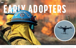
For more top insights into the latest fire prediction technology – like drones, satellites and AI models – read Meteorological Technology International’s exclusive feature here.